
Be Part of the Solution: WFCRC and its Action Plan for the Ocean
Jennifer Thomson
The World Federation for Coral Reef Conservation (WFCRC) is an organisation with global aspirations: to mitigate the decline of the world’s coral reefs through legislation and individual participation, driven by GIS data collected by a worldwide network of scientific divers. In this latest interview, the founder of WFRCR, Vic Ferguson, has kindly agreed to chat about the exciting projects and technologies that WFCRC uses - to achieve these aims.
Hi Vic! Tell us a bit about yourself, and your organisation – the WFCRC!
I have always been an Earth scientist; I just did not realise it. In my youth, I was intrigued by our oceans and questioned the logic behind our use of the sea as a dumping ground. However, I also thought that there will come a day where humans will be the solution for our oceans, rather than the problem. This passion has led me to establish the World Federation for Coral Reef Conservation (WFCRC), a 501 (c3) international non-profit organisation that engages in coral reef and coastal conservation programs.

Sylvia Earle and Vic Ferguson at the UN Ocean Conference in 2017. Photo: WFCRC.
The WFCRC was founded in 2008 as a volunteer, community-based monitoring protocol designed to measure the health and safety of coral reefs on a global scale, whilst acting locally through conservation initiatives. We have developed a workflow to demonstrate how sharing data between stakeholders is essential for making informed decisions about the health of the world’s coral reefs. To reach an even larger population, we have created and offer information to libraries and other media outlets throughout the world, in particular the use of GIS maps for local communities!

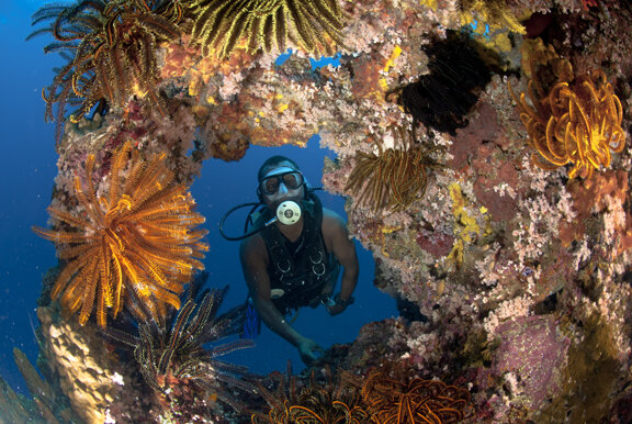
Diver with wall coral. Photo: WFCRC.
You have an impressive background in GIS! For those that do not know, briefly describe what GIS is, and how this tool can be used.
GIS (Geographical Information Systems) is a tool that lets users analyse and interpret geographical data, to help them understand relationships, patterns, and trends. Maps are one of the most effective ways to present data. They display where we live, where we move, who we interact with and, ultimately, where we are headed. The impact of GIS has touched urban planning, environmental analyses, asset management and a variety of other industries that utilise geographical data.
GIS mapping's greatest benefit is that it essentially does most of the work for you. Most GIS software offers users a section to input all of the numerical data to display on a map. The corresponding map is updated in real time to reflect said data. Anything with a location component to it, can be seen on GIS maps, and these can be produced in a matter of minutes. It’s hard to imagine our day-to-day lives without GIS - as research shows more than 77% of smartphone owners regularly use navigation apps.
One part of WFCRC’s research involves a GIS coral mapping program called R.E.E.F.S. Please describe this fascinating project! How will the R.E.E.F.S initiative impact local communities?
The Research Enhancement Engineering for Seascapes project (R.E.E.F.S.) is an initiative designed to greatly benefit local coastal communities, who rely on coral reefs for their recreational and economic benefits. From this project, we have created a citizen science mobile mapping tool. It will enable them to log in, update their location on a map, and report on various parameters relating to coral reefs at their location. These observations will be published to a database that in turn will create a map in GIS, to be used in various conservation measures, and by various stakeholders in St Maarten:
Managers of Marine Protected Areas (MPAs) – this group also includes responders to coastal and marine disasters such as oil-spills and cyclones. The maps arising from this project will provide them with vital information as to where these corals are, and how to mitigate damages.
Scientists – they are trying to understand the reef ecosystem with respect to coral reef ecology, bleaching, diseases, and best practices for successful conservation, and will be able to access in-situ maps of numerous reef parameters which they can use in their research.
Recreational divers – want to see coral reefs maintained, and will be interested in reporting the state of coral reefs, as well as viewing the various updates from other users.
In the future we are hoping to work in locations such as Tanzania, Kenya, Indonesia, and Mexico!
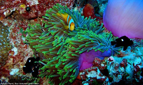
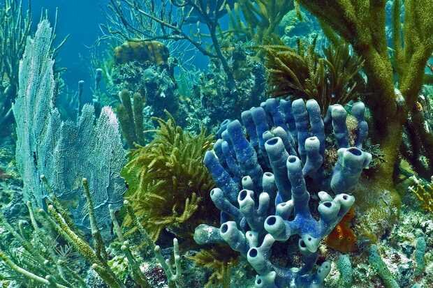
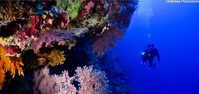
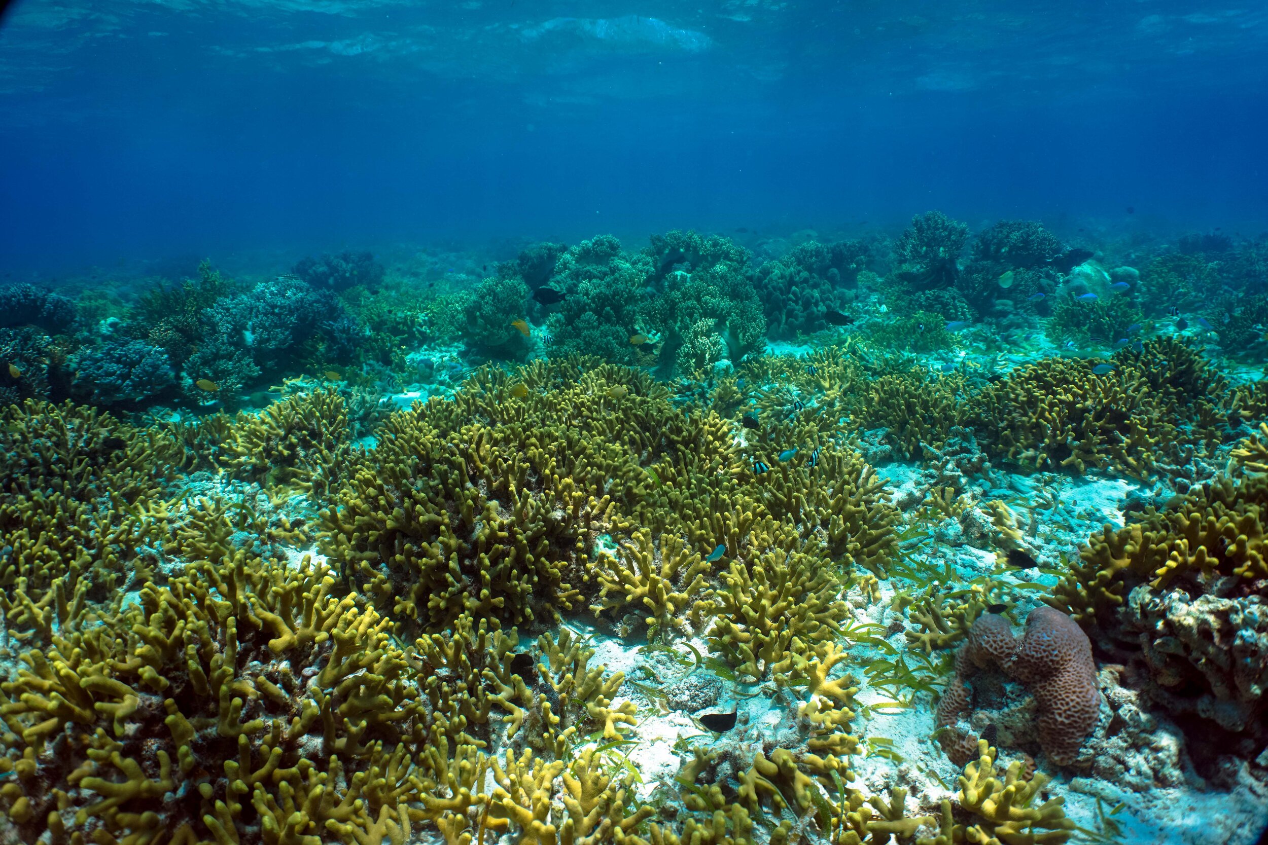
What WFCRC aims to map - Corals (part 1): Anemone fish and coral (top left), blue coral (top right), coral sea (bottom left), feather star arch (bottom right). Photos: WFCRC, with permission from Alasdair Harris (Blue Ventures Conservation) (top left) and Undersea Productions (bottom left).
How important is it to use remote sensing tools such as satellite data for ocean monitoring, and do you think the use of large-scale monitoring tools will become a routine practise in the future?
Remotely sensed data is the cornerstone of coral reef monitoring. This visualisation allows for identifying global reef decline/growth and species identification, and is already being utilised: various remote sensing tools such as NASA’s CORAL and Landsat satellites. When combining satellite and drone imagery, one can see a total operational view of the transitional zones between land and water, and therefore use this to predict future threats. I agree that this will become one of the most routine monitoring methods!
WFRCR is a large-scale effort of marine coastal networking – involving innumerable people from around the globe. How hard is it to coordinate such an international and collaborative programme?
WFCRC manages a global network of reporting stations in coastal and key coral reef areas. They provide all reporting stations with Emergency Reporting Documents (ERDs), requesting information about the severity of an incident (scale of incident), location, responsible party, etc. The reporting station then emails the ERD to WFCRC. Reporting stations around the world report any local incidents which could have an impact on the coral reefs in their area or in the surrounding region. WFCRC is then able to provide this reporting station with the WFCRC Best Practices so that they may respond in an effective and timely manner to the incident. Reporting stations or any interested party can use the program’s website to access WFCRC Best Practices and other incidents reported, participate in discussion forums, or get in contact with other stations in the area.
Currently, as you might imagine, maintaining a complex organisation across different locations is very difficult due to COVID! However, by making sure all companies have access to our information, this helps to alleviate any issues.

WFCRC earned a GuideStar Bronze Seal for Transparency in 2020. This means that their collaborators and stakeholders have even more reason to trust in their organisation, as this information can be accessed. Photo: WFCRC.
How important is citizen science in facilitating the work of WFCRC?
If our current level of marine conservation is any indication of future conservation success, we are in a great deal of trouble. There is not one country, organisation or group that can address the problem in the time frame needed. That is why we need citizen scientists! In WFCRC, as trends emerge from the data that citizen scientists gather; this can drive our GIS Portal. This portal will facilitate the creation of viewable metadata story maps, that provides the argument for better data-driven decisions, for example the one used in the R.E.E.F.S project. Currently COVID-19 has delayed some of our efforts, but only for a while. We are still “out there” digitally, just not personally!
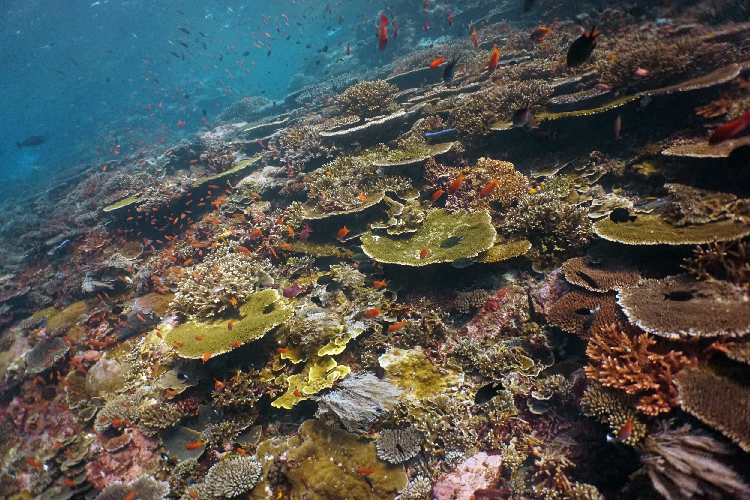
What WFCRC aims to map - Corals (part 2): Coral reefs in Komodo (left) and Hoga (right). Photo: Mads St Clair Baker.
You’ve come a long way with WFCRC, what are the plans for the future?
Ten plus years ago, my colleagues and I were reliving some of our dive experiences and discussing the future of our environment. We saw some major changes on the horizon. People were increasingly aware of environmental issues like global warming, water scarcity and climate change threatening ecosystems, livelihoods, and economies around the world. The ever-changing times in which we live requires us to learn more about our planet and adapt to our discoveries. If we wish to protect the environment for future generations, humans simply cannot participate in a “business as usual” scenario anymore.
My colleagues and I would elect to fundamentally transform our view of the future and turn environmental obstacles into restoration opportunities; anchoring the World Federation for Coral Reef Conservation’s (WFCRC) mission and vision. Thus, this message is directed to all world citizens with little to no regard for the consequences that will be created ‘tomorrow’. It is what we can do today that allows us to pass a healthy environment on to the next generation. But the WFCRC has a plan. We call it: Performance with Purpose. From the start, we knew this would not be easy, and that the changes we hope to bring will not happen overnight. Furthermore, we know it will still take work to overcome the many doubts of citizens who don’t engage with the issues of climate change and other environmental efforts. But we also know that being a considerate citizen is fundamentally critical in improving the health of our oceans.
A decade into our journey, and we were making important progress. We are consulting with our marine biologists, earth scientists, and concerned citizens for their professional knowledge base. Many citizens are unaware that in 2015-2016 we measured the world’s third mass coral bleaching event which scientists described as the most severe on record. However, we see a light at the end of the tunnel. By placing action plans in the hands of the communities that need it, at the right time, we can work to reverse some of the damage and help restore balance to our oceans.
Looking back over the last decade we have significantly improved the way we connect with resources, local leaders, and global citizens with our environment. We know that the success of any plan depends on the combined forces of local stakeholders, small businesses who use the oceans, and leaders – all of whom are regularly consulted for how we can better help their community invest in cleaner oceans and healthier reefs. We achieve this investment by holding local town hall meetings, events, contacting other concerned citizens who reach out to us and by just listening to the ‘beat’ of the ocean research.
As a certified diver for over 50 years I have had wonderful experiences in the world’s oceans and have always felt that the ocean was just part of my home. It is in our best interest as citizens to protect all seas and keep them clean. I imagined that someday we might reach an inflection point, one from which we could not return. As it stands, I do not believe we have reached that point, and we can be the solution.
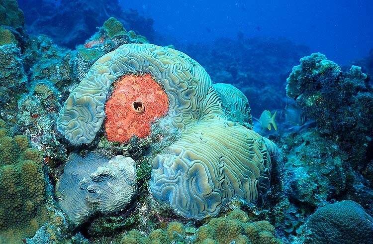
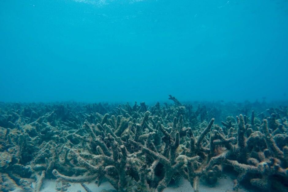
What WFCRC aims to protect - Corals: Brain coral (left) and dead coral field (right). Photo: WFCRC.
You can follow Vic’s work and WFCRC on Twitter @WFCRConserve, Instagram @wfcoralreefconservation and check out their amazing work website.
Want to be interviewed by us? Check out our ‘Get Involved’ section.